Toggle Nav 
Search
Our Sites
Visit our other sites
-

Fapas - Proficiency Testing
Globally recognised provider of proficiency tests, running over 400 tests annually across an extensive range of matrices and analytes
-

Great Crested Newts Testing
A single sample taken by an ecologist at any time during the newt breeding season can determine their presence or absence, saving you time and money
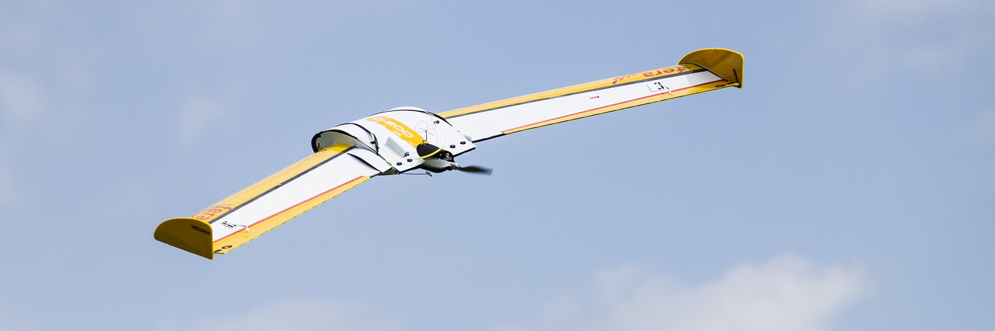
- If you need to survey an area of land for development, crop or vegetation monitoring, land condition assessment or any other spatial or mapping study – you can save considerable time, money & resources with Fera’s Unmanned Aerial Vehicle (UAV) services.
- Contact us
Begin a partnership you can trust to keep you one step ahead
Whether you need to survey land to monitor crop health or yields, identify tree species, assess vegetation cover, or map large sites to determine ground conditions and resource availability, our Remote Sensing and Geographical Information Systems (GIS) scientists can use cutting-edge UAV and sensor technology to supply all the imagery and analysis you need.
-
High-resolution aerial imagery and 2D/3D mapping.
-
Knowledge-led surveillance and inspection technology for better informed decision-making about land management and planning.
-
Specialist data analysis to reduce planning and development costs.
-
Cutting-edge technology and scientific expertise for a service tailored to your needs.
Our UAVs can be deployed to capture bespoke aerial imagery over agricultural, forestry, quarrying, open mining and construction environments. Our UAV service goes far beyond simply supplying you with imagery. We offer enhanced tools to help you capture, quantify and understand your survey area, while our expertise in photogrammetry, image processing and image/GIS analysis, enables us to tailor our service to provide exactly the data you need.
Data mapped and presented just the way you want it
Your data can be shared with you in a way that allows you to extract maximum value from it. We can provide the raw data, hard or soft copy maps highlighting output information, 3D models and fly-throughs, or produce raster or vector GIS files. We can also present the imagery data in bespoke web applications that allow you to log in and interact directly with the information.
Our services

CAA-approved pilots and procedures
Fera has been granted Permission for Commercial Operations (PfCO) from the Civil Aviation Authority (CAA). This allows Fera to fly UAVs for imagery collection in line with CAA regulations. All of our surveys are undertaken by fully qualified UAV pilots who are also skilled in both Remote Sensing and GIS.
Before conducting any flight, the Fera UAV team will:
- Discuss your requirements and set out how we will achieve them.
- Carry out a pre-flight survey to ensure the project is feasible.
- Compile flight plans to ensure the area of interest is fully covered during UAV flights.
- Check that we have the land owner’s permission.
- Confirm a day to undertake the flight in line with weather forecasts.
- Check the airspace and NOTAMs to ensure it is safe to conduct a flight.
- Carry out an on-site survey and risk assessment.
- Carry out pre-flight checks on the UAV.
Why choose Fera UAV services?
-
The right UAV for the task
We operate both fixed-wing and rotary UAVs which means we can fly different UAV depending on the customer requirement.
-
A range of sensor payloads
We have a number of different sensor options that can be fitted to our UAVs allowing us to capture the imagery you need.
-
Detailed identification of vegetation stress
Crop or tree inspections can be targeted, saving time and money over walking a field or woodland
-
Very high image resolution capture
Between 2.5cm to 5cm depending on the flight height. This high resolution is ideal for identifying features on the ground.

Our services
Spatial services
Fera scientists use Geographical Information Systems (GIS) and geographic analysis to visualise, analyse and interpret data in a spatial manner to help governments, policymakers and planners understand relationships, patterns and trends.
Fera spatial services include:
- Data capture and conversion.
- Spatial analysis.
- Data management.
- Spatial data modelling.
- Spatial statistics.
- Data processing.
- Cartography.
- Web mapping.
- Mobile GPS data collection.
- 3D visualisations.
Specific UAV applications and case studies:


Remote sensing services
Fera’s remote sensing team has a proven track record of working with remotely sensed data from a range of satellite sensors, combined with imagery collected by our own fixed-wing and rotary UAVs. These remote sensing capabilities offer essential services for a range of applications, including:
- Satellite, aerial and UAV imagery interpretation and classification.
- Multispectral, hyperspectral, Radar and LiDAR imagery processing, correction and classification.
- Land cover classifications.
- Tree species classification.
- Agricultural mapping and stress detection.
- Mining and construction surveying.
Meet the Team

Dr Andrew Crowe PhD - Senior Spatial Data Scientist
Andrew is part of Fera's Sustainable Agriculture and Environment group,
where his main interest is the collection and analysis of geographic
information to support agricultural and environmental monitoring.
Andrew's recent work has focussed on supporting economic valuations of
ecosystem services and estimating stocks of natural capital, while his
current focus is around the development of remote sensing, in-field data
capture and web-based technologies for agricultural monitoring.
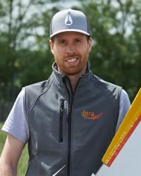
Paul Brown MSc - GI Remote Sensing Scientist
Paul is a GI Remote Sensing Scientist at Fera with an extensive range of experience in Remote Sensing, Image Processing and GIS analysis. Leading and contributing to an assortment of projects including; UAV tree species classification for inspection targeting, agricultural land cover mapping for Defra, a temporal palm tree health study in Mozambique and individual crop counting from UAV data for future yield estimating. Prior to joining Fera in early 2014 Paul has worked for Airbus Defence & Space, gaining a wealth of experience from a broad variety of Remote Sensing and GIS consultancy projects. Paul is also a CAA-approved commercial UAV operator.

Lee Butler MSc, CGeog (GIS), FRGS - GIS Specialist
Lee's background is in GIS, spatial data analysis and cartography and he
has been working in the geospatial field for over 10 years. Lee is a
Chartered Geographer, specialising in GIS and a Fellow of the Royal
Geographical Society. His recent work at Fera has focused on developing a
mobile data collection solution for field workers using hand held GPS
devices, smartphones and tablets. Lee's current focus is around the use
of web mapping and web applications for the dissemination of imagery and
spatial data. Lee is also a CAA-approved commercial UAV operator.
Why choose Fera UAV services?
-
3D elevation data capture
Using photogrammetry we can capture ground height elevation, enabling us to produce accurate 3D as well as 2D mapping.
-
3D site fly-through production
Using surface height data we are able to create detailed 3D models and fly-throughs.
-
Automated flight programming
Ensures the UAV captures all the required imagery data over the site in the most efficient way.
-
Repeatable mission options
Enables us to fly the same area repeatedly to monitor changes over time.
Copyright © 2025 Fera Science Limited (“Fera”). All rights reserved.
Registered Office: York BioTech Campus, Sand Hutton, York, YO41 1LZ. Registered in England & Wales, No 9413107. VAT Registration ID: GB 456401013
For further information about how Fera uses any personal data collected from you, please see our Privacy Notice at www.fera.co.uk/privacy-policy.
For further information about how Fera uses any personal data collected from you, please see our Privacy Notice at www.fera.co.uk/privacy-policy.