Visit our other sites
-
Fapas - Proficiency Testing
Globally recognised provider of proficiency tests, running over 400 tests annually across an extensive range of matrices and analytes
-
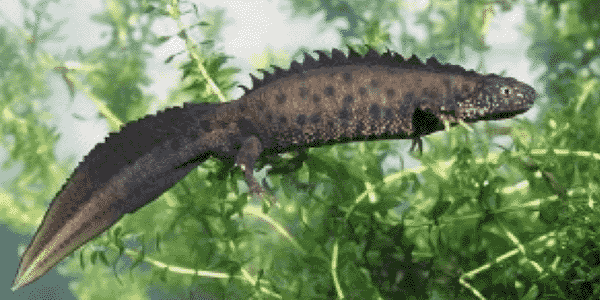
Great Crested Newts Testing
A single sample taken by an ecologist at any time during the newt breeding season can determine their presence or absence, saving you time and money


WHAT IS LAND360?
LAND360 is Fera’s natural capital assessment service.
Combining data and science, LAND360 accurately measures, and maps existing land habitat features and models biodiversity offerings to help farmers, landowners, estate managers and housing developers make informed land use decisions.
WHO IS LAND360 FOR?
FOR ESTATES
With the introduction of the Environmental Land Management schemes (ELMs) and the drive to manage land in a way that recognises ‘public money for public goods’, understanding the extent of natural capital available across a farm or certain area of land is going to become increasingly important.
With Fera’s R&D expertise and scientific knowledge, we’ve created a reliable service capable of measuring, monitoring and assessing natural capital that estate managers and owners can use to create this necessary baseline.
FOR FARMERS
As well as continuing to produce sufficient, high-quality food, farmers and landowners are being encouraged to deliver a range of environmental benefits. These include clean water, improved water quality, wildlife habitats and carbon sequestration.
Taking measures to understand the natural capital your land has offers a chance to identify its true value, and introduce measures that will ultimately enhance it.
FOR HOUSING DEVELOPERS
Developing and delivering frameworks that support the creation of sustainable communities and living environments is already hugely important to house builders. With new legislation coming into play from February 12th 2024, Biodiversity Net Gain (BNG) will play an even greater role in sustainable developments.
At Fera Science, we understand the importance of science in helping house builders meet sustainability, BNG, and carbon reduction targets. Our team of experts can provide a range of services to support developers in their efforts to enhance nature and biodiversity.
MEET THE LAND360 TEAM
LAND360 PACKAGES
Whether you're seeking comprehensive baseline information on natural capital or the provision of land management options to support future revenue streams, LAND360 has four packages designed to support farmers, landowners, and land agents when making sustainable land use decisions for the future.


An initial, comprehensive baseline mapping service for larger areas. Based on Ordnance Survey (OS) MasterMap parcels, this layer provides large scale land management stakeholders a robust, low-cost entry to LAND360. This service helps to identify focus areas for further analysis.
*This package is available as an individual product or a subscription-based plan based upon your organisation’s mapping requirements.


A comprehensive baseline mapping service that provides a robust foundation for strategic land management planning and provides the data to make informed decisions.


A step on from LAND360 Mapping+, this package uses habitat condition surveying to accurately quantify natural capital, providing tangible insights that encourage sustainable land management decisions.


LAND360 Ecosystem+ is a service whereby land use proposals are developed in conjunction with land management decision makers, stakeholders, and Fera scientists to identify opportunities for future revenue streams. This is based on a detailed analysis gathered on available natural capital and business performance.


LAND360 IN ACTION
Find out how Estate businesses have used LAND360 to support their future land management decisions.
CASTLE HOWARD ESTATE
Castle Howard Estate in Yorkshire is working with Fera Science’s LAND360 team to map out the biodiversity and carbon footprint of the 9,000-acre (3,520ha) mixed-use estate, consisting of farmland, woodland and parkland.
HELMINGHAM ESTATE
By using science and data to create a natural capital baseline, the LAND360 team at Fera is helping one Suffolk estate continue its journey towards driving long-term environmental sustainability and profitability.
LAND360 AT CASTLE HOWARD ESTATE: FARMER ENGAGEMENT EVENT
Organised by Fera and NFU, we hosted an informative farm walk and visit to Castle Howard Estate. Watch the video to learn more about how practically improving efficiency and environmental sustainability can inform management decisions, and in turn support a resilient and thriving farm business.
Our LAND360 Blog
Discover further LAND360 insights and resources to help you identify tangible natural capital and biodiversity opportunities on your land.
WHAT MAKES LAND360 DIFFERENT?
LED BY SCIENCE
LAND360 provides tangible results through the interpretation of data and use of scientific insight.
MULTIDISCIPLINARY TEAM
From economists to ecologists, agronomists to scientists, Fera has a wealth of independent expertise and experience to inform recommendations for land management decisions.
PROVEN TRACK RECORD
Research teams at Fera have a long track record of supporting government & policy, practitioners and land managers in monitoring & evaluating agri-environment schemes designed to support environmental sustainability.

Copyright © 2025 Fera Science Limited (“Fera”). All rights reserved.
For further information about how Fera uses any personal data collected from you, please see our Privacy Notice at www.fera.co.uk/privacy-policy.


