Visit our other sites
-
Fapas - Proficiency Testing
Globally recognised provider of proficiency tests, running over 400 tests annually across an extensive range of matrices and analytes
-
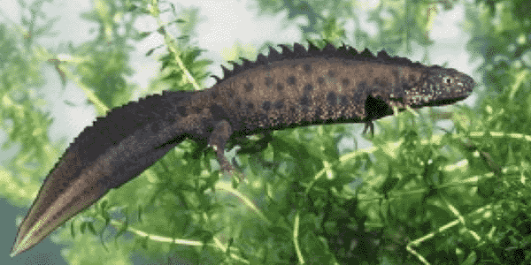
Great Crested Newts Testing
A single sample taken by an ecologist at any time during the newt breeding season can determine their presence or absence, saving you time and money
Andrew is a senior Spatial Data Scientist at Fera, working with a variety of environmental data to help map and analyse spatial patterns in rural and agricultural landscapes.

Find Andrew on: LinkedIn
-
Area of expertise
Spatial Analysis
-
Years of experience
15+
-
Highest qualification
PhD
Andrew is a member of Fera’s Land Use and Sustainability team, where his main interest is the collection and analysis of geographic information to support agricultural and environmental monitoring. He works on a wide range of topics, including tree health and biosecurity, monitoring of agri‑environment schemes and the mapping of ecosystem services. Prior to joining Fera, Andrew worked on the National Ecosystem Assessment and the Countryside Survey.
More on Spatial Analysis and Remote Sensing
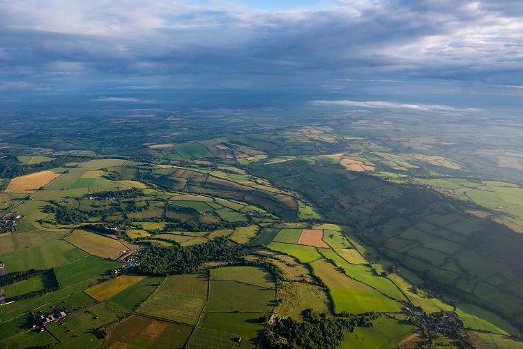
Whether you need to survey land to monitor crop health or yields, identify tree species, assess vegetation cover, or map large sites to determine ground conditions and resource availability, our Remote Sensing and Geographical Information Systems (GIS) scientists can use cutting-edge UAV and sensor technology to supply all the imagery and analysis you need.
Fera scientists use Geographical Information Systems (GIS) and
geographic analysis to visualise, analyse and interpret data in a
spatial manner to help governments, policymakers and planners
understand relationships, patterns and trends.
Latest Papers and Articles
Gillespie, M. A., Baude, M., Biesmeijer, J., Boatman, N., Budge, G. E., Crowe, A., ... & Senapathi, D. (2017). A method for the objective selection of landscape‐scale study regions and sites at the national level. Methods in Ecology and Evolution.
Woodcock, B. A., Isaac, N. J., Bullock, J. M., Roy, D. B., Garthwaite, D. G., Crowe, A., & Pywell, R. F. (2016). Impacts of neonicotinoid use on long-term population changes in wild bees in England. Nature Communications, 7, 12459.
Budge, G. E., Garthwaite, D., Crowe, A., Boatman, N. D., Delaplane, K. S., Brown, M. A., ... & Pietravalle, S. (2015). Evidence for pollinator cost and farming benefits of neonicotinoid seed coatings on oilseed rape. Scientific Reports, 5.
Bateman, I.J., Harwood, A.R., Mace G.M. …Crowe, A. … & Termansen, M (2013) Bringing ecosystem services into economic decision making: Land use in the UK. Science, 341 (6141), 45-50
Maskell, L. C., Crowe, A., Dunbar, M. J., … & Smart, S (2013). Exploring the ecological constraints to multiple ecosystem service delivery and biodiversity. Journal of Applied Ecology, 50, 561–571
Events past and future
18-22 September 2017: IUFRO 125th Anniversary Congress, Freiburg, Germany

Andrew and their team work with customers to deliver the following services within Fera...
Environmental and Ecosystem Mapping; Geographic Analysis of Data; Spatial Data Management
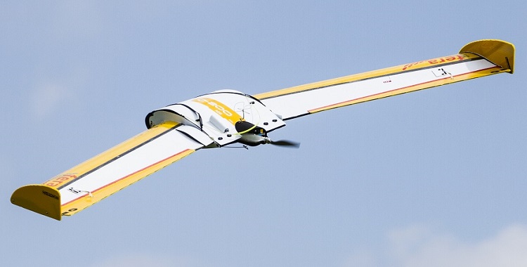
Remote Sensing & Mapping
If you need to survey an area of land for development, crop or vegetation monitoring, land condition assessment or any other spatial or mapping study – you can save considerable time, money & resources with Fera’s Unmanned Aerial Vehicle (UAV) services.
Economics
We help societies to become more resilient or achieve the three pillars of sustainability through combining bottom and top-down decision making approaches under rapid socio-economic changes. Fera can help you to understand the likely impacts and cost-effectiveness of your decisions and actions, so you can make well-informed choices on how to deploy the economic resources available.
Environmental Planning & Policy
Fera is in a unique position to combine academic research, big data, forecasting models and information from a host of sources to inform practical environmental solutions and policy decisions across the public and private sector.
Latest Papers and Articles
Gillespie, M. A., Baude, M., Biesmeijer, J., Boatman, N., Budge, G. E., Crowe, A., ... & Senapathi, D. (2017). A method for the objective selection of landscape‐scale study regions and sites at the national level. Methods in Ecology and Evolution.
Woodcock, B. A., Isaac, N. J., Bullock, J. M., Roy, D. B., Garthwaite, D. G., Crowe, A., & Pywell, R. F. (2016). Impacts of neonicotinoid use on long-term population changes in wild bees in England. Nature Communications, 7, 12459.
Budge, G. E., Garthwaite, D., Crowe, A., Boatman, N. D., Delaplane, K. S., Brown, M. A., ... & Pietravalle, S. (2015). Evidence for pollinator cost and farming benefits of neonicotinoid seed coatings on oilseed rape. Scientific Reports, 5.
Bateman, I.J., Harwood, A.R., Mace G.M. …Crowe, A. … & Termansen, M (2013) Bringing ecosystem services into economic decision making: Land use in the UK. Science, 341 (6141), 45-50
Maskell, L. C., Crowe, A., Dunbar, M. J., … & Smart, S (2013). Exploring the ecological constraints to multiple ecosystem service delivery and biodiversity. Journal of Applied Ecology, 50, 561–571

Events past and future
18-22 September 2017: IUFRO 125th Anniversary Congress, Freiburg, Germany

Andrew and their team work with customers to deliver the following services within Fera...
Environmental and Ecosystem Mapping; Geographic Analysis of Data; Spatial Data Management

Remote Sensing & Mapping
If you need to survey an area of land for development, crop or vegetation monitoring, land condition assessment or any other spatial or mapping study – you can save considerable time, money & resources with Fera’s Unmanned Aerial Vehicle (UAV) services.

Economics
We help societies to become more resilient or achieve the three pillars of sustainability through combining bottom and top-down decision making approaches under rapid socio-economic changes. Fera can help you to understand the likely impacts and cost-effectiveness of your decisions and actions, so you can make well-informed choices on how to deploy the economic resources available.

Environmental Planning & Policy
Fera is in a unique position to combine academic research, big data, forecasting models and information from a host of sources to inform practical environmental solutions and policy decisions across the public and private sector.

Copyright © 2025 Fera Science Limited (“Fera”). All rights reserved.
For further information about how Fera uses any personal data collected from you, please see our Privacy Notice at www.fera.co.uk/privacy-policy.
